Remote Capture - Aerial Photography

Drone Photography for Mining, Farming, Land Management and Environment Imagery. 

Limited Offer 
Second Visit Imagery at half price!* (Big $ Value)

For 2026 we are offering follow up site visits at half the rate to new clients. If you have a project make contact today!

Let's Talk ...
Call (08) 6117 3829 or

About Remote Capture 

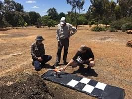
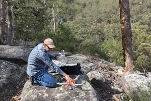
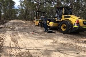
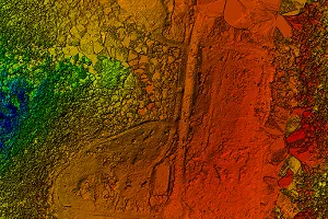
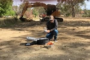
Remote Capture goes to remote and difficult locations throughout Australia to get useful images for your project.


Our drone photography work is an extension of  mineral exploration, mapping and land consulting services over many years.


We have experience getting into remote areas, working to timetables, being passionate about the land and it's potential uses.

Why Choose Remote Capture?

At REMOTE CAPTURE, we take high quality images of your project area. We are flexible to arrange site visits using our resources (or yours), our teams (or yours), our processing power (or your experts). Our imagery will help you manage your project.

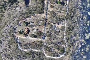
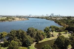
If you manage land, are interested in property or report to others about what is happening on any land, then our imagery can give you an advantage. 

What is Your Project?

  •  Mineral Exploration? We have worked on projects all over Australia and Internationally
  •  Land Management for Cultural, Heritage and Artifact projects
  •  Farmland and crop condition
  •  Water management and vegetation 
  •  Intense management of large areas such as golf courses, playing fields, resorts, bush walking trails
  •  Scheduled repeat imagery for seasonal or land use differences

Drone high resolution and lower cost is a Game Changer for aerial work

What Sort of Project would Be a Fit?

Yes, we can do Urban Real Estate or Commercial work, but that is not where we shine.
The following are examples of where we can add the most value to a project.

Mineral Exploration

Send us out into the bush instead of your expensive team members. It can be more efficient bringing the images to the desktop.  

Land Management

Drone photography is an excellent solution if you need to check sensitive cultural areas or report back to official bodies. Repeat visits gives insights of how humans and animals are 'using' the land under your supervision.

Property Developers

If you are clearing or building on land, you need to keep up to date on what is going on in every corner. Drone photography helps Architects, Landscapers, Sub-Contractors and Government officials to play their part. 

Vegetation Changes

When you manage land the subtle changes in vegetation can tell you what is important. See it sooner in order to respond in time. Our imagery can be captured after rain or dry spells, before your harvest, before you spend money on fertilizer or landscapers. Being able to 'see' what is out there is going to make you more efficient.

Copyright 2019-2026 - Remote Capture

Special Offer Second Site Imagery at half price conditions: The same flight plans must be re re-flown within 6 months. The half rate applies to the piloting, image capture and processing only and  excludes all other expenses such as travel, consumables, logistics. The project costs that qualify for the half rate will be as itemized from the first capture.